In addition to importing survey data to GIS feature classes and automating the production of chart mxds, AutoChart for ArcGIS also includes some 3D design functionality to generate Trench and Berm features, either in a Plan sense or now by creating grade features on a longitudinal profile.
As ever there is a video you can watch that outlines the process:
Create Trench/Berm on Surface
The Create Trench and Create Berm commands will modify an existing Surface TIN feature to add trench or berm features based on the specified parameters.
A feature class containing the required line feature(s) to create the Trench/Berm along is then selected.
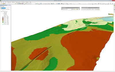
The TIN surface data is modified to create a new TIN containing the design features:
ArcScene can be used to view
the surface in 3D:
Create Grade Profiles
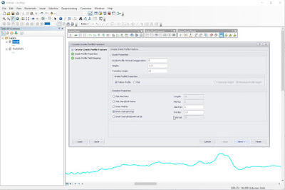
A Longitudinal Profile Feature class at a suitable vertical exaggeration can be created directly from a Surface Feature and a Route line feature using the Create Profile command.
The Create Profile Feature command can then be used to generate Berm and Trench features along the profile based on specified design parameters.
Various creation methods can be used, either creating an individual grade feature for a fixed length at a selected position or entered Kp value, picking the start and end locations or entering their Kps, or creating multiple features at a defined interval between a specified Start and end Kp.
Enter the grade settings and choose the method of creation – below we are making Berms every 50m; Kp 0.650-0.800 with a flat top:
Which results in four berm features being added along the profile:
Here we are making a Trench from Kp 1.000 to Kp 1.500 following the profile above:
The Trench Grade feature is then created following the profile depths:
If required, the grade profile can be modified using standard ArcView tools such as Reshape Feature:
Grade Surface From Profiles
Next we apply those Grade Profiles to our Surface to add the new Trench and Berm features
Firstly choose which profile grade features to use:
The command creates a new overall surface, a pre and post
surface for each grade feature and set of polygons that detail the volumetric
difference between each feature and the original surface.
The Polygon Feature Class showing the volumetric information of each feature in the Attribute Table:
Viewing the modified Surface TIN in ArcScene:
A separate Surface TIN is created for each new feature
If you have any questions about this functionality please get in touch with us at Support@Wishsoftware.com


No comments:
Post a Comment